23 November 2013

A Return to Providence's "Smart City" downtown redevelopment

A protected tree trunk in the redevelopment area on Dyer Street. Downtown Providence, Rhode Island.

A few Saturdays ago I returned to Providence, Rhode Island to survey what work has been completed of the knowledge economy redevelopment of the Interstate 195 corridor area. I first visited the site a year ago--see this post for more information--and I wanted to document the change since then. As these images below show, the city started to transform the space into its new, smart future. The full photoset is available on Flickr.

"Smart" earth moving


"Smart" concrete drainage pipes


A "Smart" tractor.


A "Smart" sunset?


"Smart" concrete road barriers.


peripheral landscapes

Charles de Gaulle Airport, Paris. July 2012.


What has not been realized at all is any corresponding automation of the production of built structures [compared to what information technology and automated production have done for work environments and other fields]. This has meant that in relative terms buildings have continued to become more expensive, while other goods have become cheaper. The volume of new construction is now less than it used to be, and western cities have not changed anything like as much as was expected in, say, the early 1960s. Most of the new landscapes which have evolved as a result of computer-driven change have been peripheral, and either ephemeral and relatively insubstantial--the logistics warehouse, the container port, the business park--or, if more substantial, have been realized only because they generate very high profits--the shopping mall, the airport.

--Patrick Keiller, from the essay Popular Science, included in The View from the Train (Verso 2013, p. 70).

02 November 2013

parallel lines.

Powerlines and a lightpost alongside Bartram Avenue, Philadelphia. July 2013.

28 October 2013

Above-ground impact of the 2nd Avenue Subway construction

2nd Avenue at 86th Street in Manhattan, looking north. September 2013.
 
The megaproject tunneling underneath 2nd Avenue in Manhattan, scheduled to sync into the New York City Subway system in December of 2016, has provided some marvelous images of the process of digging enormous passageways underneath existing streets and inhabited buildings, in order to actually construct the subway line. Another much, much more visible but, I would argue, less noticed element of this project is the re-purposing of part of 2nd Avenue itself to stage the construction equipment and materials, house the project managers, and provide ventilation and access to the digging sites all has to locate somewhere, and that somewhere is, at least in the 2nd Avenue and mid-80s blocks, in the far eastern lane of the boulevard.

A collection of eight streetlights awaiting placement. September 2013.

A space intended to move traffic has been transitioned--for the time it takes to complete the digging below--into a construction site for a project invisible to see above ground. Like most building sites in Manhattan, this one is loud at times with the rumble of large trucks carting away soil and debris, but the material is nowhere to be seen, carried up from the underground load-by-load, driven off somewhere else, perhaps to New Jersey? In the meantime, 2nd Avenue is home to a collection on-site office trailers, what the Center for Land Use Interpretation terms "the invisible architecture of the urban environment".


Note the signage on the blue tarps indicating what business is obscured by this construction structure. The muted, neutral grey of the temporary building speaks well to its "invisibility". September 2013.
Looking south into the construction area. September 2013.

For more great photos of documenting the process of building the subway line, New York City's Metropolitan Transit Authority's Flickr page is worth a look. The MTA's Flickr account is a great example of the utility of social media to city agencies - there is lots of behind the scenes, under and above-ground photos of areas of New York City that most visitors and residents are never able to gain access to.

14 October 2013

Essay published: Everyday Landmarks of Networked Urbanism

 In downtown Philadelphia not far from City Hall,a cellular antenna array is located on top of an AT&T mobile phone retail store and a hair salon. Photograph taken by author, 2013.

The current issue of the Journal of Urban Technology was just released; it includes an essay I wrote, Everyday Landmarks of Networked Urbanism: Cellular Antenna Sites and the Infrastructure of Mobile Communication in Philadelphia. Readers of this blog will recognize many overlapping themes and concerns in the essay as it more formally details the research on mobile communication systems and ubiquitous computing infrastructures in Philadelphia.

The journal's publisher, Taylor & Francis, offers fifty free downloads of the essay at this link for those of you without academic affiliations.

The abstract and introductory section of the essay follows.

At the center of the image is an AT&T cellular antenna affixed to an electricity pylon alongside the Schuylkill River flyover for Roosevelt Boulevard in Fairmount Park, Northwest Phila- delphia. Photograph taken by author, 2012.
Everyday landmarks of Networked Urbanism: Cellular antenna sites and the infrastructure of mobile communication in Philadelphia

ABSTRACT: Harnessing the utility of mobile communication and the mobile Internet is a common, everyday aspect of the urban condition today. The wireless connectivity these pocketable devices harness is produced through an electromagnetic overlay that emanates from cellular antenna and towers. These sites have a distinct if often overlooked presence in the urban landscape of the United States. Through fieldwork in Philadelphia, Pennsylvania, this essay examines the aesthetic impact of telecommunications network equipment such as cellular sites as a means of locating these sites as key socio-technical actors in one of the information and telecommunication infrastructures of contemporary, networked urbanism.


Alongside the Schuylkill River on the western edge of downtown Philadelphia, two of AT&T’s cellular antenna arrays are bolted to the top of this building, 500 South 27th Street, which is a prominent node in AT&T’s national telecommunication network. Photograph taken by author, 2011.
Introduction
Study a city and neglect its sewers and power supplies (as many have), and you miss essential aspects of distributional justice and planning power. Study an information system and neglect its standards, wires, and settings, and you miss equally essential aspects of aesthetics, justice, and change. (Star, 1999: 379, citing Latour and Hermant, 1998).

Anywhere a connection to a mobile communication network can be found, a cellular site is nearby. Cellular antenna broadcast their communicative potential throughout an area, disregarding distinctions between public and private spaces—as well as the built and natural environment—as the network equipment connects individuals to each other and to the Internet via larger systems of fiber-optic cabling, data centers, and so on (for further discussion of the engineering of telecommunications systems, see Ascher, 2007; Hayes, 2006). To check an email, find directions with a locative mapping program, interact with social media, or to access any number of other uses of the mobile Internet requires the dispersal of ubiquitous, monotone grey and white, thin vertical rectangular boxes mounted throughout high points in a city. The “always-on” nature of mobile connectivity is created through the maintenance of these cellular networks, a situation described by human-computer interaction as well as urban scholars as “ubiquitous computing”, which is defined as the dispersal of computing power—through devices like mobile phones—into the urban landscape itself, with the subsequent changes to urban movement and the flow of information throughout a city and the world (Dourish and Bell, 2011; Greenfield and Shepard, 2007; Weiser, 1991). The potential of ubiquitous computing is inherently dispersed throughout a city’s “electromagnetic terrain” (Mitchell, 2003: 55), but at the same time the connection to information and communication networks requires the cellular sites—among other equipment such as wireless Internet (wi-fi) routers—from which this service emanates.

The individual device, such as an Apple iPhone, may fit in a pocket, but the background network is immense, stretching across cities and encompassing much of the world. The last leg of the infrastructural support is wireless and immaterial, but the rest of the system exists as distinct spaces of network equipment embedded within the landscape (see Ascher, 2005: 130-131; Hayes, 2006: 303-311 as well as Graham and Marvin, 2001). As the writer Andrew Blum’s work charting the infrastructure of the Internet shows, data centers house the servers which contain our digital information footprint; a vast array of terrestrial and submarine fiber-optic cabling transmits this information (Blum, 2012), and the final connection to the user can be made through cellular antenna (Hayes, 2006). The aesthetic design and utility of, for instance, an Apple iPhone is of particular concern to the individual user and to Apple, but the design of the infrastructural support is more mundane, similar to other elements of municipal infrastructures such as electricity pylons or wooden telephone poles tying together fixed-line telecommunication systems. Because cellular sites often sit higher than the surrounding city, they become what engineers Claire Barratt and Ian Whitelaw call an “everyday landmark” of the city (Barratt and Whitelaw, 2011: 184). Considering cellular sites as landmarks of contemporary networked urbanism is a productive first step in examining the role this equipment play in cities today.

Philadelphia presents a productive location for examining these issues because the city encompasses many interwoven urban eras from the Colonial to the post-industrial present day. The physical infrastructures of modern, nineteenth-and-twentieth century Philadelphia—water, electricity, gas, street transportation and railroads—are layered with the late twentieth century’s information and communication infrastructures, as well as freeways, a major airport, and the ubiquitous connectivity systems of the twenty-first century, on a street grid originally laid out in the seventeenth century by the city’s founder, William Penn (Dunn and Dunn, 1982: 5). Freestanding cellular sites in Philadelphia often occupy the interstitial margins of the city, wedged into an empty lot alongside a major roadway or standing over a residential neighborhood. While an analysis of the locations of cellular sites indicates that many of the skyscrapers and other buildings of the central business district have cellular antenna either on top of or bolted to the side of their walls, these locations are high up on private property and consequently difficult to observe (General Data Resources, 2013).
  
The infrastructural aesthetic for cellular equipment seems to focus on presumptions of invisibility and anonymity as well as functional concerns placed before formal design considerations. Muted colors such as whites and greys dominate, with seemingly little attention paid to the impact on integrating the design of the structure with the urban fabric of the adjacent neighborhood. The towers’ heights are meant to disperse the cellular signal over a large area, while the antenna themselves act as a “base station” sending and receiving radio-transmission of information are typically clustered in groups of three parallel to the ground to broadcast their signals (IEEE, 2012b). At the street-level, these towers and their attendant ground-level equipment are typically surrounded by a chain link fence displaying some information about who owns and operates the tower, such as AT&T or Verizon, as well as one or more “No Trespassing” signs. Cellular sites are a perpetually repeatable component dispersed throughout cities and the world to provide wireless network connectivity; the aesthetic intent of this equipment is not locally variable nor does it readily adapt to the particular historic legacies of the neighborhoods in which the equipment is situated. Even so, cellular sites may not have a unique presence in the landscape, but they are still a key actor the networks enabling information exchange in cities today.

This essay focuses on the equipment that supports the wireless exchange of information in the urban space of Philadelphia as a means of locating and grounding these immaterial flows in the built and natural environments of the city itself, of making visible the systems responsible for transforming the landscape into a space for the active, wireless transmission of information. I first discuss mobile communication and the mobile Internet as a component of networked urbanism today using recent developments spatializing and urbanizing Actor-Network Theory to do so (Farias and Bender, 2010; Latour, 2005; McFarlane, 2011). The majority of the essay takes the information and infrastructure studies scholar Susan Leigh Star’s call for ethnographies of infrastructure (1999), from which the introductory quote is drawn, to investigate the aesthetics of cellular antenna and tower sites. The intent of this examination is to draw attention to this new layer of urban infrastructure that in less than twenty years has become a pervasive element in the landscape of cities and open spaces throughout the United States, and to consider what it takes for a mobile computing device to connect to the globalized telecommunications networks.

[continues...]

To read more of the essay, go to the Journal of Urban Technology's site at Taylor & Francis to download the final essay for free; the pre-production version of the essay is available for download as a .pdf here.

KEYWORDS: infrastructure, wireless, mobile communication, cellular antenna tower, Philadelphia, AT&T 

Standing high above its south Philadelphia neighborhood, this AT&T cellular tower backs on to the playground for a community center. Photograph taken by author, 2012.

07 October 2013

Thinking the ‘smart city’: power, politics and networked urbanism

Because every discussion of "The Smart City" has to have a enthusiastic but generic image to convey city-ness, this image shows some buildings in central Philadelphia with dappled sunlight reflecting from one mirrored surface onto another. Photo by Alan Wiig, March 2013.


My Internet and urbanism, geography colleague at Clark University Taylor Shelton (@kytjs) and I are organizing a session at the 2014 Association of American Geographers annual meeting, in April in Tampa, Florida. We are looking for a few more contributors, so please reach out if the topic correlates with your research interests (contact emails below).


Thinking the ‘smart city’: power, politics and networked urbanism

Organized by Alan Wiig (Temple University) and Taylor Shelton (Clark University)

The fact that cities are increasingly being augmented by digital hardware and software, producing massive amounts of data about urban processes, has been well documented in recent years. Discourses around so-called ‘smart cities’ and tend to position them as either a panacea, an entirely new conceptual and material breakthrough, or as a kind of dystopian imposition of technological rationality onto cities, leaving the precise nature of this social and spatial reorganization unclear. This session will engage these issues through empirically-focused, but conceptually-rich, research on how digital information and communication technologies do not simply connect cities to distanciated networks, but also drive new forms of urban development and new methods of civic exchange and political contention between municipalities and their residents.

This session seeks papers that document and analyze how these new socio-technical systems are reconfiguring the relationships of urban governance, and how these systems remain embedded in longstanding social structures at both local and global scales. We are also interested in how geographers might offer a unique perspective on the processes and outcomes of smart urbanism, especially given the dominance of computer scientists and management consultants in the making of these projects. Possible topics might include, but are not limited to:

-- Policy mobilities and the ‘smart city’ model
-- Politics of urban data
-- Smart cities and technocratic planning
-- Smart cities as new urban entrepreneurial assemblages
-- Virtual spaces in the networked city
-- Role of transnational corporations in promoting smart city developments
-- Smart cities and urban environmental sustainability
-- Smart cities in the Global South
-- Cybernetics and the intellectual history of smart urbanism

Please submit abstracts of no more than 250 words to Alan Wiig (alanwiig [at] temple.edu) and Taylor Shelton (jshelton [at] clarku.edu) by October 21 to ensure sufficient time for review.

05 October 2013

Considering the energy demands of mobile connectivity


In the center of the image on the far wall is a mobile phone charging station in Boston's South Station during the afternoon rush hour. Photo by author, August 2013.

What is the role of electrical energy and batteries in enabling mobile communication? How might we develop a practically-minded, spatial grammar through which we could describe the material/electrical/digital relationships between energy, mobile communication and digital connectivity, social exchange, and personal mobility? Beginning a year or so from now then continuing in the summer of 2015, I will be an international visiting fellow of the DEMAND Centre at Lancaster University in the United Kingdom. To quote from their website, DEMAND--Dynamics of Energy, Mobility, and Demand--"takes a distinctive approach to end use energy demand, recognising that energy is not used for its own sake but as part of accomplishing social practices at home, at work and in moving around. In essence the Centre focuses on what energy is for." The Centre takes the dynamic, interconnectedness of practices of mobility of bodies, goods, and information, and the energy consumption needs that are inherent in providing these services, as an entry point to understanding what energy is used for and why those uses are considered valuable.
 
A close-up of the charging station in Boston's South Station. The description on the screen states: "Battery low? Charge up here. Charges faster than a wall charge." There is a credit card swipe and what looks like six plugs for the most common mobile phones. The service provider, Go Charge (motto: "Never miss a moment"), seems to be capitalizing on users running out of battery and not having a charging cable and plug with them. When unbroken connection to social media, etc. is deemed essentially mandatory, the underlying systems necessitate not just providing pervasive connectivity--through cellular infrastructures and the like--but also having energy in the battery that powers the mobile computing device. Photo by author, August 2013.

Tying to my longstanding interest in the spatial ramifications of the Internet and mobile communication, my project will examine how electrical energy is used to provide individuals with these services. What is the role of charging and batteries in powering these Internet-enabled computing devices--smartphones primarily--that connect users to the global telecommunication systems that in turn mediate a significant portion of everyday social exchange? The central issue motivating this project is: how do individuals negotiate keeping their communicative, computing devices charged and how is this impacting the landscapes of everyday mobility such as train stations and airports, railroad cars and airplanes? How are buildings and transit systems adjusting to the increasing demand for power and electrical outlets to charge personal computing devices, and, in turn, is the need for charging areas impacting considerations of the design and layout of these transit nodes? These empirical questions lead to more theoretical considerations about the materiality of energy in the form of batteries, the high-design of devices--such as an Apple iPhone--versus the utilitarian intent of the charging plugs, cables, and wall sockets, and even to the sociology of standards that are latent in all these considerations. 
 
For this project I will document the informal, everyday practice of charging and recharging devices by conducting an visually-motivated ethnography of the role of electricity and batteries, and the process of charging electricity into batteries, that enables mobile communication. I will develop a conceptual framework to then approach a socio-spatial understanding of the everyday practice around the--most likely--multiple intersections of charging, batteries, mobile communication, and general, personal mobility in and around Lancaster and connecting to London and the United Kingdom at large. 

Seat-based power outlets in Boston's Logan International Airport, with signage for the service both on the chair-backs and on the adjacent wall, stating "power up". Negotiating a flight today necessitates topping up a laptop or smartphone's battery so work or entertainment can continue until arrival at an intermediary airport or the end-destination itself. What is interesting from an electricity perspective is that power generation and delivery is regional whereas the inter-connectivity of the Internet and global telecommunication systems is--by their very nature--not regionally bound. In many ways the overarching story of digital communication is not about bits and bytes transmitted over distance but of the pulses of light--energy--contained within fiber optic cabling that move about, becoming a text message or an email or a video of a cat.


Preliminary fieldwork in train stations in the North-East United States and airports throughout the US as well as Heathrow indicates that with the exponential increase in the use of personal, mobile computing devices, the need to power and recharge these devices is constantly growing. While individually, these smartphones do not draw much energy, how extensive is the overall demand for electricity to power these digital things? Is this demand considered by planners of current and future transit operations? 

For now I have more questions to guide the research than findings to report. I have started a photo-set on Flickr of charging stations and charging practices in train stations and airports as a way to collect some preliminary fieldwork-documentation of this topic. The set can be viewed here.


23 September 2013

parking lot, radar, cellular antenna, and the moon in the background

Worcester Regional Airport. Photo taken the morning of 23 September 2013.

22 July 2013

from infrastructural tourism to tourism on and within infrastructure

Sunset at Hetch Hetchy Reservoir. Summer 2008.


Shannon Mattern, Media Studies Professor at the New School in New York and a generally interesting, provocative scholar-artist, published an essay at Places: Design Observer  on Infrastructural Tourism earlier this month. She makes an excellent argument for making infrastructure of all varieties visible, material, political, and fun through an examination of a variety of artists and scholars and other groups whose work investigates the networked landscapes of the commonplace things and systems that are often taken for granted even as these infrastructures are as vital as ever.

Reading the essay, I started thinking about the opposite side to this documentation of infrastructure, that of infrastructure as a destination for tourism in and of itself. In the American West, a common example of this is the use of large water reservoirs for recreation: boating, jet skis, fishing, picnics, hiking and cycling, camping, and so on. Water that comes out of the tap downstream acts as sporting or entertainment when retained behind a dam for a time.

One of the more remote reservoirs in the Sierra Nevada Mountains is Hetch Hetchy Reservoir, which provides water and hydroelectric-generated power for the City and County of San Francisco as well as other cities in the Bay Area. Hetch Hetchy Reservoir is located in Yosemite National Park, a long, windy drive on narrow, potholed roads from Highway 108 between Groveland and the entrance to Yosemite. The watershed is protected; any recreational use of the reservoir such as swimming, boating, and fishing is prohibited, but it is still a worthwhile visit, especially since virtually none of the crowds visiting Yosemite Valley make the journey.

I was fortunate to visit with a group of friends in the summer of 2008. The access gates to the area are closed to traffic at night, so you have the entire area to yourself. Even water and electricity flow west to San Francisco constantly, connecting the area intimately to the urban landscapes of Northern California, the area encompassing Hetch Hetchy Reservoir itself is quiet and calm; not disconnected but at a remove from the urban places it was built to provide for.

Unlike much of the work discussed in the Infrastructural Tourism essay, reservoirs are big, visible reminders of the reach of urban water systems, even if they typically are found far out in the hinterlands, out of site from the population centers themselves. The topic of infrastructures as sites of tourism deserves a much fuller consideration than I am offering here; but in the meantime, I've included three more photos from my visit to Hetch Hetchy below.
Playing music in a tunnel carved out of granite. The acoustics weren't bad.
Bunkhouse accommodation.

Downstream from Hetch Hetchy Reservoir is a small pool situated alongside the Tuolumne River. 


03 July 2013

Walking to Newcastle International Airport: A photoessay

Leaving Durham, England...

Past a mini roundabout at the edge of town.
To Newcastle International Airport, flying to Philadelphia via Heathrow's Terminal Five on the fringe of London.

After I check my suitcase I have a few hours before the flight leaves. Walking around outside with the idling taxis, I notice a route sign for pedestrians into and out of the airport. This would be a rarity in the United States--no one walks to the airport! But apparently in Newcastle, this is an option. The path winds alongside this glassy, Doubletree by Hilton with its placeless, airport-international styling.


 Behind the Doubletree hotel, the airport path intersects with a sidewalk that runs alongside B6198, a peripheral road that proceeds alongside the airport's perimeter. Across the road is the Premier Inn, with a slightly dated, cartoonish aesthetic.

Next to the Permier Inn the sidewalk continues past the Prestwick Terrace, a residential sliver bounded by roads, rails, and airport parking.

A gate and the runway just past.

The path continuing alongside B6198. I turned around about here because rain was starting to fall and I didn't have an appropriate jacket to put on.

On the way back I notices the cellular antenna sites mimicking the flagpoles--one on either side of the three white poles in the center of the image. Mobile communication infrastructure and the logistics systems--including places for individuals to stay before or after taking a flight--cluster around airports.

And then waiting for my flight to board, looking back out at the landscape.

27 June 2013

Exploring the Landscape of Smart Urbanism in Philadelphia


The new corporate office cluster of the Philadelphia Navy Yard, a special economic zone for the southeastern Pennsylvania region, with its executive putting green in the foreground. For more photos see my Navy Yard photoset on Flickr.

What follows is an initial draft of research I presented at two conferences this June, first at the Symposium on Urban Informatics: Exploring Smarter Cities at Drexel University in Philadelphia, then a week later at the Smart Urbanism: Utopian Vision or False Dawn? International Roundtable Workshop at Durham University in the United Kingdom.

Smart Urbanism in Philadelphia: Utilizing Social and Technical Systems to Promote Economic Growth

In this essay I examine Philadelphia’s engagement with the smart city concept through two interconnected projects, the Digital On-Ramps workforce development efforts that originated from consultation IBM's Smarter Cities Challenge provided, and the city’s economic branding and marketing efforts “Philadelphia: Smart City, Smart Choice” (pdf). My overall argument is that, while there will likely be many productive outcomes of both projects--new industries and jobs in those new industries for marginalized city residents--through these new, technologically-mediated forms of civic engagement and economic promotion, the greater utility of the ‘smart city’ is to present Philadelphia as an innovative, competitive node in the global economy.

The smart city as a concept can be defined as the municipal adoption of software, hardware, urban sensor networks, smartphone applications, or other forms of ubiquitous computing technologies to improve on urban issues and to achieve particular goals, such as economic growth. While there are numerous visions for the potential of smart urbanism to target localized, neighborhood-focused urban change, in Philadelphia the rhetorical utility of the concept has an economic, business-focus that translates to similar deliverables in the Digital On-Ramps project.

Programming for an Intelligent Philadelphia

The Digital On-Ramps workforce education effort emerges out of a proposal put forward to IBM's Smarter Cities Challenge, which was established in 2010 to provide free consultation to cities around the world around implementing technological solutions to urban problems. The Challenge ends this year, having consulted on approximately 62 of the intended 100 recipients. Cities asked for help on a number of issues, from workforce development to ecological sustainability to urban renewal. Philadelphia was part of the initial 2010 round of consultation. Mayor Nutter’s Office asked for help conceptualizing a workforce education portal to link unemployed or underemployed residents to online, easily accessible job training for work in emerging industries.

Initiated through the discussion with IBM, as well as ongoing work with a number of city government, educational, and non-governmental organizations (here is the list of partner organizations), the Digital On-Ramps project is advancing toward full implementation in the near future. The rationale for the project comes out of acknowledging the endemic poverty, low high school graduation rates, low overall literacy, and limited access to computers and broadband Internet among significant numbers of the city’s population, all contributing to long-term difficulty finding jobs. Digital On-Ramps seeks to overcome these multiple, inter-connected issues by providing a platform for ‘anytime, anywhere’ learning, a portal to train city residents across access platforms, from smartphones to tablet computers to desktops. The easy-accessibility is a convenience intended to allow users to participate when and where they have the time, instead of requiring users to travel to a particular place for the workforce training. The idea is that a user could learn the digital interface for a piece of office or manufacturing equipment, and then to connect that person with a company looking for workers knowledgeable in that equipment. Digital On-Ramps had an initial roll out in spring 2013 with 500 high school students at four schools participating. With this soft start, the project is targeting the advanced manufacturing industry as an initial focus for employment.

Advanced manufacturing is a very new industry that is slippery to define still. The push for this sphere of industry stems from efforts from the United States' federal government to reinvigorate the manufacturing capabilities of the United States by fostering business that centers on high-tech, high-precision, flexible and nimble production model, with the further ability to adjust to changing demands and products. 

A significant issue, however, is that the industry is brand new and Digital On-Ramps recipe for securing work for participants has not yet been proven. Beyond that, Digital On-Ramps is targeting the marginalized neighborhoods of the city that have not recovered from the post-industrial blight that has defined large regions of the city for the last fifty years, and it is not clear where these jobs in advanced manufacturing might be located.

Smart City Smart Choice


Now I will to shift to look at Philadelphia’s other application of the ‘smart city’ terminology: its place-based economic marketing and branding efforts, “Philadelphia: Smart City, Smart Choice”. The “Smart City, Smart Choice” marketing campaign is a component of Philadelphia’s business services web-portal, and is a nicely done introductory document to show the business-friendly side of the city. In the document, ‘smart’ refers to the central location of the city in the greater Northeastern United States as well as the many transportation options into the city, the opportunities for higher education and hiring a trained workforce, and the quality of life married to an affordable cost of living.

‘Smart’ in this example becomes a rhetorical device intended to promote a vision of the city as a creative, innovative, intelligent place to set up a business. This promotion ties in to the city’s efforts to re-cast Philadelphia in a more positive light, not as the next Detroit but as a city with the potential to regain its economic strength.

While Digital On-Ramps presents a new, productive way of providing workforce education and outreach, it can only do so much. Both it and the “Smart City, Smart Choice” campaign’s use of smart city language seek to bring economic growth to Philadelphia, but neither offer a clear pathway to improving marginalized neighborhoods in the city; instead the focus seems to be either in other, peripheral areas far from the city’s central neighborhoods, or in the already-strong, already well-developed central business district.

To an extent, the landscape of the smart city or the smart economy in Philadelphia is locating in areas away from the historical, industrial districts, the areas that have suffered the most decline as the city has transitioned away from its industrial economy and toward an information-based, service economy. While these new projects may provide jobs for residents throughout the city, the overall economic development does not seem to be bringing industry back to the core areas of the 19th and 20th century industrial economy.

The former site of the Stetson Hat Factory in North Philadelphia.The factory complex burned down in 1980 and nothing has been rebuilt in the intervening years.
As an example of this change, the location of what was the Stetson Hat Factory in North Philadelphia, just east of Temple University, is telling. I present it to show what an area of the city's modern industrial economy looks like today--to be fair, not every formerly-industrial neighborhood looks like this, but many do. The factory closed in 1971 and burned down in 1980, but until it closed this was where the iconic cowboy hats of the American West were manufactured. Today, forty years on, the site sits abandoned, like much of what was Philadelphia’s industrial core. While some of the post-industrial areas of the city have been gentrified into residential neighborhoods, sites like this one are not uncommon.

Zonespaces of the Globalized Information Economy

Looking north from the Delaware River waterfront.
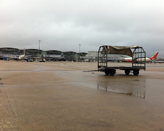
As a means of exploring the spatial consequences of smart urbanism in Philadelphia, I want to pivot here to look at where advanced manufacturing, among other facets of the new, globalized economy, are locating in Philadelphia. The Philadelphia Navy Yard is of the city but not in the city. It is an extra-urban special economic zone--as Keller Easterling terms it, a zonespace--for the global economy at the far southern fringe of the city itself. This 1000 acre, public-private development opened in 2005, after the US Navy turned it over to Philadelphia in 2000. Approximately 100 businesses employ over 8,500 people in the complex. There are numerous incentives for businesses to locate in the Navy Yard, including exemptions from state and local income tax, real estate tax, and sales tax at least until 2018. The entire zone is separate from the city, with security guards at the road entrances and the visible presence of Philadelphia police, but also geographically: two major freeways, a railroad corridor, and the professional sports complex divide the area from the southernmost neighborhoods of the city proper. With the twenty-four hour private security, the Navy Yard is only open to the public during business hours Monday through Friday. At the far side of the zone, the Delaware River separates the area from New Jersey. 
While Digital On-Ramps could be considered a-spatial due to its use of pervasive connectivity--a participant would not even have to be within city limits to access their account, the outcomes of these information and communication technology-driven economic development projects can be located. The spatial consequences of the dual smart city/smart urbanism discussion in Philadelphia can be seen in places like the Navy Yard, which is why I want to highlight its presence in the city.

The Navy Yard could be one of the best-maintained area of the city. With its mix of historic naval officers quarters, barracks, warehouses, industrial buildings, and new office buildings, it looks like a cross between the grounds of an established, sprawling university and a suburban, corporate research campus. Mature shade trees line the streets, bike lanes are newly painted on the recently resurfaced pavement, and there is little traffic except at the start and end of the work day.

Glaxo Smith Kline's new offices, employing an contemporary aesthetic rarely seen in Philadelphia proper.

Tasty Cake, PNC Bank, and Glaxo Smith Kline have built new buildings close to the entrance, while Urban Outfitters houses their global headquarters on the waterfront in a series of long and low renovated brick factory buildings. On the western end of the zone there is still shipbuilding businesses; the Navy houses research and development work, and both Penn State and Drexel University have research clusters.

A former Marine Corps barracks acts at a hub for the region's advanced manufacturing industry. The Building 100 Innovation Center is where advanced manufacturing has been developing in the Philadelphia region--federal grants run through offices located here, and the emerging industry is rooted in this location. Conceivably if an advanced manufacturing factory were to open, it could do so in one of the many historic factory buildings available for conversion nearby, which in turn could offer jobs to the Digital On-Ramps participants looking for work in the industry.

The Building 100 Innovation Center in the Navy Yard, where the early advanced manufacturing industry is locating in the Philadelphia region.

There are other areas of the city and the region where new industries and precision manufacturing are located, but little if any of these businesses can be found in the marginalized neighborhoods that have been targeted for participating in Digital On-Ramps. The emerging landscape of a smart Philadelphia has yet to re-invest in the areas that once represented the city’s innovation and economic wealth, such as neighborhoods of North Philadelphia surrounding the Stetson Hat Factory site.

Conclusion 

In the dynamic, changing landscape of Philadelphia today, the emerging economic activities that are targeted as contributing to ‘the smart city’ are to a large extent not found in the same locations as earlier industries. As a rhetorical device contributing to place-making efforts in the globalized digital age, the ‘smart city’ discussion focuses on much more on the possibilities change could bring instead of on the actual economic situation across much of the city. For Philadelphia, the ‘smart city’ is an effort to brand the city as a location for economic development that may or may not have a widespread impact on the actual city. Thus far the new businesses such as the advanced manufacturing cluster have not located in the areas of the city that have faced significant decline in economic opportunities over the last decades. By prioritizing a smart city over smart citizens, the potential to create widespread improvements is limited by the targeted focus on a particular form of economic growth. The special economic zone model of economic development that the Navy Yard represents is a new, global, extra-urban device that is located in the city but offers a new, unprecedented example of how to produce economic growth ways disconnected, geographically separated from the rest of the city itself.

Afterword

The Navy Yard's website contains much easily-accessible information, including the master plans for the complex, a printable walking tour (pdf), and information about the Commonwealth of Pennsylvania's Keystone Opportunity Zones, areas where taxation is reduced or eliminated in the interest of promoting economic growth. In addition to Rob Holmes of Mammoth as well as others, I am very interested in the spatial and political implications of special economic zones and free trade zones. Much of the discussion of these spaces seems to position them as elsewhere, far from city centers for instance, when, as the Navy Yard indicates, these places are already part of cities in the United States, their impact spreading throughout the country.

Finally, I have actively returned to using Flickr in the last few months, after a hiatus of at least four years. While the service is not perfect, it is easy to use; I'm considering it as a photographic back-end to this blog, where I can organize and update images that relate to my greater geographic research interests. There is a Philadelphia Navy Yard photoset with images from three visits to the site over the last year. For those readers in the Philadelphia area, I encourage you to visit the Navy Yard. It is open to the public, full of interesting architecture, and well worth a few hours of your time.

24 May 2013

Using the smart city to promote economic competitiveness

Center City Philadelphia from Drexel Park in West Philadelphia
The lack of posting on this blog correlates directly with the state of my research on smart urbanism in Philadelphia. I hope to post more regularly soon, but in the meantime here is a teaser, in the form of an conference abstract for an upcoming event I will be participating in.

On Tuesday, June 11 I will present a bit of my recent research into smart urbanism and the 'smart city' as applied to Philadelphia at Drexel University's Symposium on Urban Informatics: Exploring Smarter Cities. In the organizers' words, the symposium will examine how "Technologies transform city life in countless ways. The symposium on Urban Informatics will bring together designers, city planners and managers, technologists, scholars and entrepreneurs in Philadelphia, at the heart of the northeast urban corridor, to explore the frontiers of the urban environment." I am looking forward to the discussions coming out of this event; it will certainly be a productive and hopefully provocative day!

What follows is an overview of what I intend to cover in my fifteen minutes.

Philadelphia’s smart city agenda: Enabling urban change or perpetuating existing social inequalities?

This essay examines what urban informatics technologies enable: how this electromagnetic terrain of a city actively impacts the urban landscape. By examining the digital infrastructure that support the Digital On-Ramps smart city project in Philadelphia, this essay will explore the systems, policies and technological scripts that produce a disposition toward responsive intelligence in the city. The Digital On-Ramps project proposes to connect Philadelphia’s under-served citizens to Internet-based workforce education and development training via smartphones, tablets, and traditional computers as a means of providing the skills necessary for these citizens to become competitive in a 21st century, globalized and service-oriented economy. Digital On-Ramps’ project requires a re-conceptualization of the infrastructure for education and content delivery, a renewed utility of digital telecommunication systems and, possibly, a lessened need for the traditional, physical spaces of schools and other established elements of the city’s built environment. All this combines with a tighter focus on new, digital actors for content delivery and consequently social and economic exchange itself. Through a place-based case study examining the numerous local and national actors involved in this smart city project, this essay will critique the push for workforce development outcomes through digital infrastructural efficiencies.

The central question the essay will address is: Does the Digital On-Ramps project benefit Philadelphia’s under-served, poorest citizens, or is the project geared more toward maintaining and improving Philadelphia’s image as a competitive, creative, and economically-relevant city in the globalized economy? The essay concludes that, while it is too early to see if, how, and where citizens will benefit from this project, the city’s smart city agenda has brought national and global media attention to Philadelphia.

25 March 2013

Reading a condemned landscape: Nature Noir and the Auburn Dam site

An unrelated but not dissimilar area south of the Auburn Dam site 100 miles: Old Wards Ferry Road between Sonora and Groveland, California. Roads like this track throughout the Sierra Nevada Foothills, barely-paved, narrow and fairly dangerous routes following old miners' tracks. This road leads to a bridge and remnants of a ferry crossing the Tuolumne River just upstream from the Don Pedro Reservoir.* Photo by author, 2010.

Geoff Manaugh's recent post on Bldgblog about Cool, California and the Auburn Dam site concludes by asking what had happened to the place since John McPhee wrote about it in Assembling California in the early 1990s. In what follows I touch on the topic in a review of Jordan Fisher Smith's Nature Noir. This essay was originally written in 2007 for The Geography of Water Resources, a class in San Francisco State's Geography department taught by Nancy Wilkinson.


Reading a condemned landscape: Nature Noir and the Auburn Dam site


 “We do not seem much to love what space there is left [in the American West].  One thinks not only of the greed of developers, which is numbingly obvious, but of a widespread nihilism that now extends through much of the population, witness the reflexive littering, the use of spray paint on rocks, the girdling of trees near campgrounds, and the use of off-road vehicles for the maximum violence of their impact.  The West has ended, it would seem, as the nation’s vacant lot, a place we valued at first for the wildflowers, and because the kids could play there, but where eventually we stole over and dumped the hedge clippings, and then the crankcase oil and dog manure, until finally now it has become such an eyesore that we hope someone will just buy it and build and get the thing over with.  We are tired, I think, of staring at our corruption.”
    -the photographer Richard Adams, from the essay Working conditions: In the nineteenth-century West (1994, 138)

    Jordan Fisher Smith spent the better part of a career as a park ranger managing Auburn State Recreation Area, a space run over by California’s Gold Rush and then discarded to be drowned under a dam that will likely never be built. The Richard Adams’s quote that opens this review succinctly addresses the conditions present in the forested hills and rocky, overgrown canyon-bottoms Smith’s stories take place in.  Smith himself became tired of the corruption Adams speaks of; Nature Noir comes out of Smith’s refusal to fall into the easy despair over the state of his piece of the Sierra foothills. Nature Noir is not a lament for a devastated landscape, instead speaking of Smith’s respect and love of a long-neglected and still threatened area and the people who inhabit it.

Auburn State Recreation Area sits an hour east of Sacramento in the Sierra Nevada foothills, containing the mountain-and-river topography formed by the north and middle forks of the American River. In this area the terrain folds up on itself, rolling hills becoming steep inclines, oak and manzanita chapparal turning mixing with pines and an occasional cedar tree. Ridgelines descend east to west, cut over geologic time by streams and rivers that flow into the delta of San Francisco Bay. To move in any direction but especially north or south requires traversing up and down steep hillsides. To patrol an area like this is never easy, as we find out in the first chapter.  Radio communication can cut out, many of the bumpy, potholed roads have had little improvement since they were gold miners tracks 150 years ago, and the people the rangers encounter, arrest, or have to save are ones who inspire dialogue like this: “ ‘Is he dead?’ a woman asked.  ‘I hope so,’ some guy answered” (Smith 2005, 17). The book is character-driven, each chapter digging into a person or a situation, speaking of tragedies and other unfortunate events, as well as small moments of beauty. Underlying the human stories and tying the chapters together is the place itself, a natural area set to drown under a reservoir, but its fate put off over and over, likely forever.
Auburn State Recreation Area is the setting for these stories and becomes a character itself. The place is inseperable from the human stories. As Smith’s partner puts it, “There are no innocent victims in this place. The same people appear in alternating roles over the years. One day your guy was a perpetrator; a week or a year later he was a victim.” Working in a curious, upside down landsape like this required faith that the site, the job, and the people would in the long term become valued, but “in any case, a park ranger is a protector. You protect the land from the people, the people from the land, and the people from themselves” (Smith 2005, 19-20). What Smith goes on to discuss is the larger situation, which was entirely out of his control: protecting the land from state and federal politicians. In 1965 a dam was authorized on the American River, more to prevent flooding in Sacramento itself than to hold water. There are no average years of rainfall in Northern California. Constant cycles between drought, dry, wet, and wetter are the norm. Within that, half a season’s rainfall can come down with one storm. This can lead to flooding in the lowland places that are today cities like Sacramento and its surrounding office parks, suburban development, and farmland. The desire to dam, retain, and control the flow of water is one of the foundational stories of California: to ensure water supplies through dry summers and drought years, to protect crops, and especially to protect property investment in areas that were once floodplains before becoming towns, and can still return to being floodplains after a particularly strong storm.

Auburn Dam’s construction was authorized in 1965. It would sit upstream from the larger Folsom Dam and, as the US Bureau of Reclamation’s website states, “provide water for flood control, irrigation, recreation, municipal and industrial uses, water quality improvement, power generation, and fisheries enhancement.”  Nine years later construction began. A year after that “an earthquake measuring 5.7 on the Richter Scale occurred near the Oroville Dam, about 50 miles northwest of the Auburn site. Although the large earth-fill structure was not damaged, the event raised concerns about the safety of dams like the thin arch concrete dam proposed for the Auburn site. In April 1976, the Association of Engineering Geologists, Seismic Hazards Committee, issued a report stating that a moderate earthquake like the 1975 event near Oroville would cause the proposed dam at Auburn to fail.” (US Bureau of Reclamation 2007). The website of the agency in charge of building Auburn Dam states that a moderate earthquake would bring down the dam. Cost estimates to build a smaller dam in the late 1990’s were estimated at over $1 billion (Carle 2004, 193). Supporters of the dam still rally for construction—in April, 2007, “a House hearing on protecting the Sacramento-San Joaquin Delta from catastrophic levee failures turned into a mini-rally for constructing an Auburn dam on the American River” (No Author, 2007). The good news for the canyons upstream from the un-built dam is that in 2002 the Bureau of Reclamation “closed the tunnel that diverted the water from the dam construction site, and let the river run again through its historic channel” (Carle 2004, 193). Chances that the dam will be built are very slim, but the supporters are still working hard to change that; because the federal law authorizing its construction has not been revoked they still have some hope.

Auburn Dam would not be the first instance of recent manipulation in these canyons. The American River in the section to be inundated by the Auburn Dam has been a site of gold mining since the start of the Gold Rush. Smith writes that, due to gold mining, “by the mid-1850s the American River canyons would have been unrecognizable to anyone who had seen them a few years before…When it was over, 255 million cubic yards of mine wastes and mud had gone down the American River alone” (79-80).  Forests were clear-cut wholesale, rivers were diverted in full, topsoil completely disappeared, and of the thousands of men who came seeking their fortune, only one in twenty came away some wealth” (Smith 2005, 79).  European Americans arrived on the American River (of couse it was not called that before the gold miners arrived) and immediately changed it irrevocably, bringing with them all the trappings of their culture and inventing what was lacking, be it hydraulic mining equipment, sturdy blue jeans, or the practice of jumping frogs for entertainment (Twain 1996). Some of the best writing in Nature Noir comes out of Smith’s disgust with how quickly and completely the California landscape was transformed:
“The novelty of rain is one of the few things I liked about hot summers in the canyons, a season I mostly detested when I worked as a ranger in them.  To be fair, however, the things I disliked about that time—the merciless sun that old forests would have shaded me from; the dust on my face, my uniform, and rescue equipment; the spiny star thistle that gets to flesh through thick jeans, wild oats that lodged in my socks, and the other disagreeable European annuals that overwhelmed the perennial meadows of the low Sierra—I eventually came to see as the marks of 140 years of bad treatment of this land.  So over time I learned to forgive this place for its bad manners and prickliness, for these are the inevitable outcomes of servitude, in land as in people” (Smith 2005, 121).
The utility of this landscape has been to provide for other places. The gold taken out of the hillsides and streambeds in the nineteenth century went to develop San Francisco and fuel the state’s economic growth. The proposed dam and reservoir would benefit areas downstream but, obviously, flood the site itself. Smith sums up this attitude, writing “The Gold Rush led to the Auburn Dam and a tradition of valuing what could be extracted from these canyons more than the canyons themselves” (2005, 80). Turning his experiece as a park ranger into stories, presenting the place as something more than the site of a proposed dam is a starting point to seeing the place differently. Water management infrastructures such as the Auburn Dam and reservoir exist to enable other uses, such as keeping Sacramento from flooding. Nature Noir tells of the social and ecological consequences when that utility is delayed indefinitely. In telling the stories of an often overlooked place, this work focuses needed attention on a section of California’s landscape where, for the most part, the stories ended when the Gold Rush petered out. The Sierra Nevada foothills have a bounty of places and people similar to what Smith describes, but not enough storytellers. This book provides a wonderful entry point into this damaged, beautiful terrain.

Sources:
   
Adams, R. (1994). Why people photograph: Selected essays and reviews. New York, Aperture.
   
Carle, D. (2004). Introduction to Water in California. Berkeley, University of California Pres.

No Author (2007). "Auburn Dam the Focus of Recent Congressional Panel, quoting David Whitney." Last accessed 17 April 2007, from http://www.auburndamwatch.org/blog/category/blog/.
   
Smith, J. F. (2005). Nature noir:  a park ranger's patrol in the Sierra  New York, Houghton Mifflin Company.
   
Twain, M. (1996). The Celebrated Jumping Frog of Calaveras County, and Other Sketches (1867). New York, Oxford University Press.
   
US Bureau of Reclamation (2007). "Central Valley Project--American River Division, Auburn-Folsom South Unit."   Retrieved 10 April 2007, 2007, from http://www.usbr.gov/dataweb/html/auburn.html.


*Addendum: I grew up in Moccasin, California, south of the Auburn Dam site and about a three to four hour drive on Highway 49, the winding two-lane highway that cuts through the 'gold country' of the Sierra Nevada foothills north-to-south. Moccasin is a company town for San Francisco's Hetch Hetchy Water and Power, the utility that provides drinking water and hydraulic electricity for San Francisco and other cities in the Bay Area. What Smith describes in Nature Noir bears close resemblance to the Southern Mines region of which Moccasin is a part. I haven't been to the Auburn Dam site itself, which is why I've headed this post with a photo from just outside my hometown.